Hualapai Valley Hydrologic Model: An Introduction Date: 2/20/2018
Hualapai Valley Hydrologic Model: An Introduction
Jamie Macy & Jake Knight
Hydrologists
USGS Arizona Water Science Center
Problem
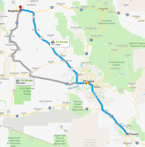
- Expanding groundwater withdrawals in Hualapai Basin could impact the City of Kingman, AZ municipal water supply
Objective
- Assess impacts from additional groundwater withdrawals and enhanced recharge in Hualapai Basin
Approach
- Groundwater Monitoring
- Groundwater Modeling
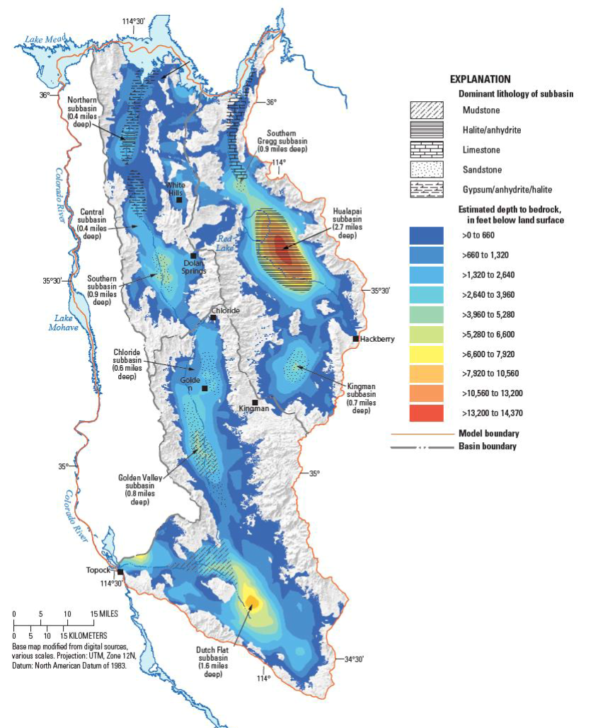
Setting and Previous USGS Studies
- Prior to ADWR Rural Watershed Initiative Program there was very little information known about Hualapai, Detrital, and Sacramento Basins
USGS studies from 2007-2013 laid the foundation
- Changes in groundwater levels over time
- Groundwater withdrawals within each basin
- The geometry of the basins and subbasins
- The basin characteristics – types of sediments and location
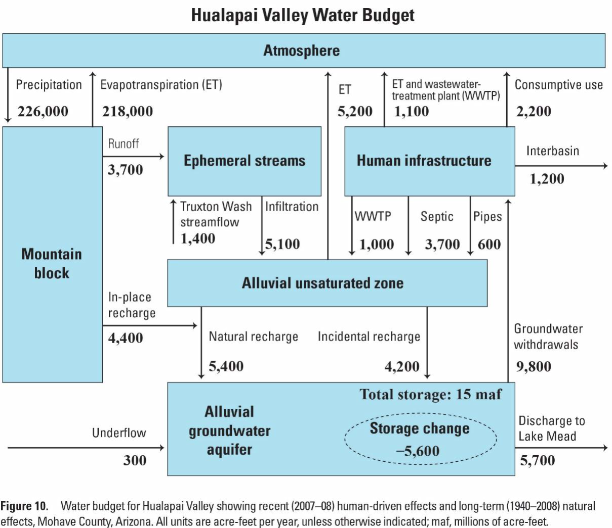
- The water budget
- A preliminary numerical model
Hualapai Basin Water Use
| Year | Agricultural Water Use |
| 2014 | 8,000 acre-feet |
| 2015 | 23,000 acre-feet |
| 2016 | 32,500 acre-feet |
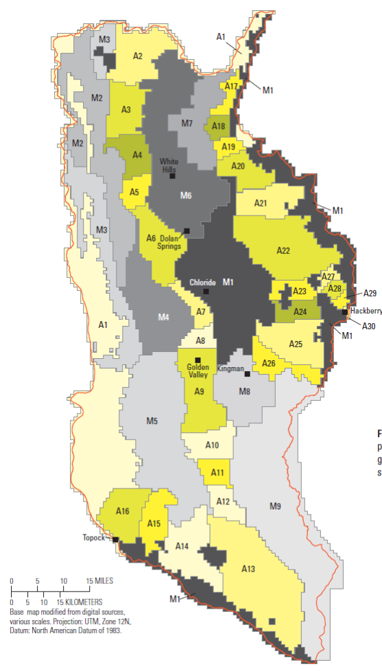
Scope of Work – Hualapai Basin
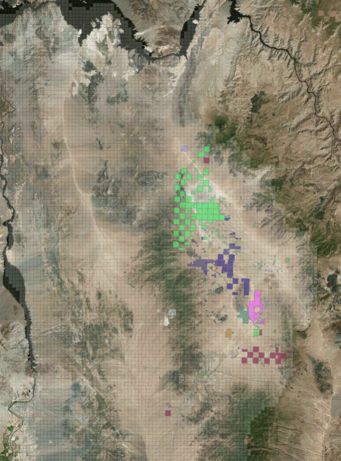
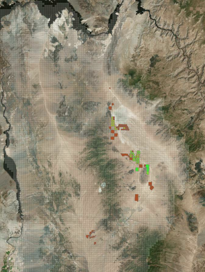
Groundwater Monitoring
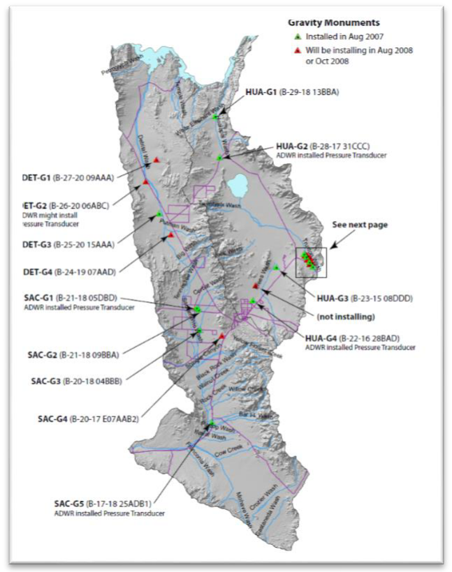
- Evaluate existing groundwater monitoring network (wells and gravity stations)
- Collect groundwater data (wells and gravity) with a focus to improve groundwater model
Model Revision and Scenario Testing
- Improve existing numerical groundwater model using new information and monitoring data
- Estimate the potential effects of groundwater withdrawals and enhanced recharge by running withdrawal and recharge scenarios
Repeat Microgravity Measurements
Changes in gravity are directly related to changes in aquifer-storage, regardless of aquifer porosity or depth-to-water:
Δg/42 = Δt, where Δt is a thickness of free-standing water
Repeat Microgravity Measurements
Changes in gravity are directly related to changes in aquifer-storage, regardless of aquifer porosity or depth-to-water:
Δg/42 = Δt, where Δt is a thickness of free-standing water
Groundwater-level trend = -1.53 ft/year
Storage-change trend = -0.36 ft/year
Large storage changes indicate an UNCONFINED aquifer
Specific yield ≈ 0.23
At other sites in Hualapai valley, repeat microgravity measurements in 2008 and 2017 indicate little to no storage change.

Timeline
Agreement signed April 2017 - Project Ends March 31, 2020
Model and Monitoring Checkpoints
- May 2018
- Model Calibration Complete
- March 2019
- Monitoring Complete
- Modeling Scenarios Complete
- March 2020
- Report Published
- Project Wrap-Up
Hualapai Valley Hydrologic Model: An Introduction
Jake Knight
Hydrologist
USGS Arizona Water Science Center
What is a Model?
A model is a simplified representation of the complex natural world.
The Modeling Process
3 Model Stages:
- Perceptual
- Conceptual
- Procedural
Procedural Model
(Tillman et al., 2013)
Advantages:
- Fast and Lean
- Faithful simulation of basin aquifer levels
- Confirms conceptual mode.
Limitations:
- Single Layer – No 3D simulation
- Forecasting capability limited
Why rebuild the original model?
A model is a simplified representation of the complex natural world and its degree of simplicity is determined by the modeling purpose.
3 Basic Classes of Models:
- Perceptual
- Conceptual
- Procedural
Purposes of hydrologic models
Interpretation:
- Basic understanding
- Estimation of aquifer properties
- Understanding present conditions
Forecasting/Hindcasting:
- Understanding past conditions
- Forecasting future conditions
Purposes of hydrologic models
| Interpretation | Original | Updated |
| Basic understanding | X | X |
| Estimation of aquifer properties | X | X |
| Understanding present conditions | X | X |
| Forecasting/Hindcasting: | Original | Updated |
| Understanding past conditions | X | X |
| Forecasting future conditions | X |
Update and Extend Model
Boundary Conditions

Update and Extend Model
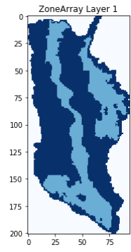
Model Layering
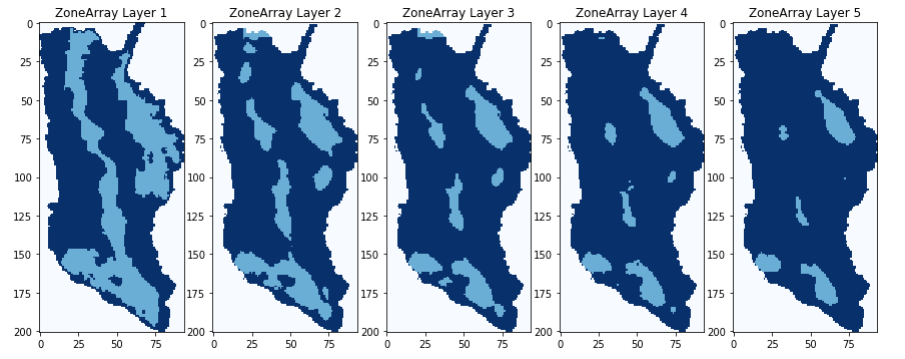
Update and Extend Model
Model Layering
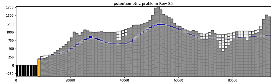
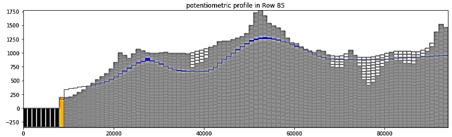
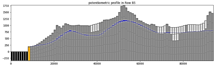
Calibrate Updated Model
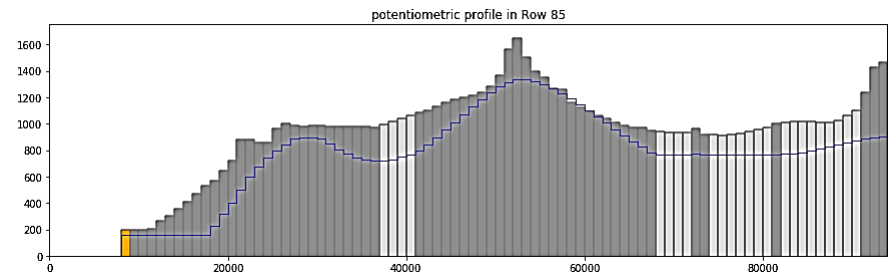
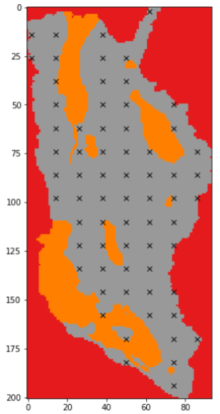
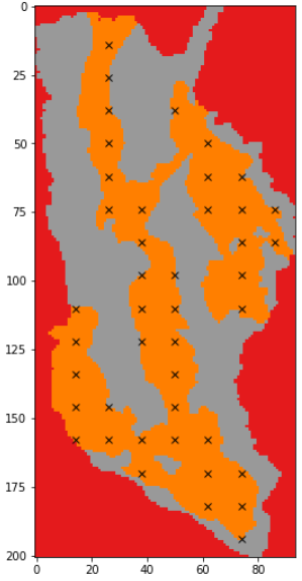
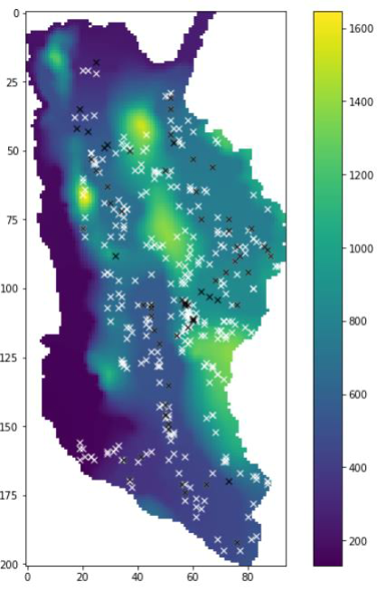
From Zones to Points

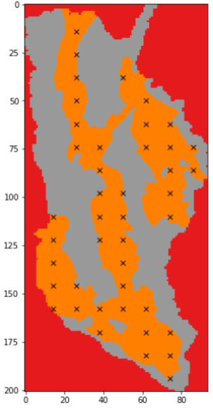
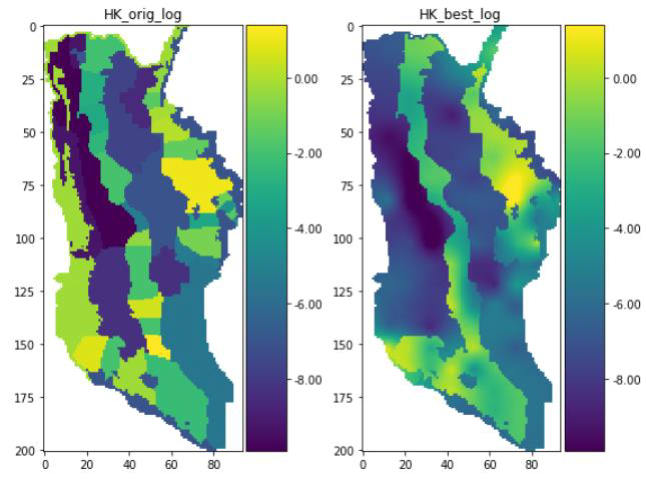
Calibrate Updated Model
Comparing Aquifer Properties
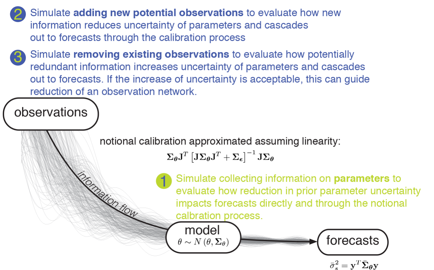
Uncertainty Analysis
Informing Observation Network Development
How informative is the current set of historical well levels?
- How much can additional well measurements improve certainty of the model forecast?
- Where are the best locations to take additional well measurements?
- More on this next time!
Summary
- Models are simplified representations of the complex natural world
- Current statusModel structure is rebuilt allowing 3D simulation, currently 5 layers
- Calibration is ongoing
- Well measurement and geophysical observation network in progress
- Next steps
- Implement refined observation network
- Run model forecast scenarios
Jake Knight
Hydrologist
USGS Arizona Water Science (Tuscon)
jknight@usgs.gov
520-670-3336
Jamie Macy
Hydrologist
USGS Arizona Water Science Center (Flagstaff)
jpmacy@usgs.gov
928-556-7276
Uncertainty Analysis
Informing Observation Network Development
What is a model?