National Resource Conservation District (NRCD) Date: 11/25/2017
Basin-Fill Aquifers of Mohave County
Geology and Hydrology Background
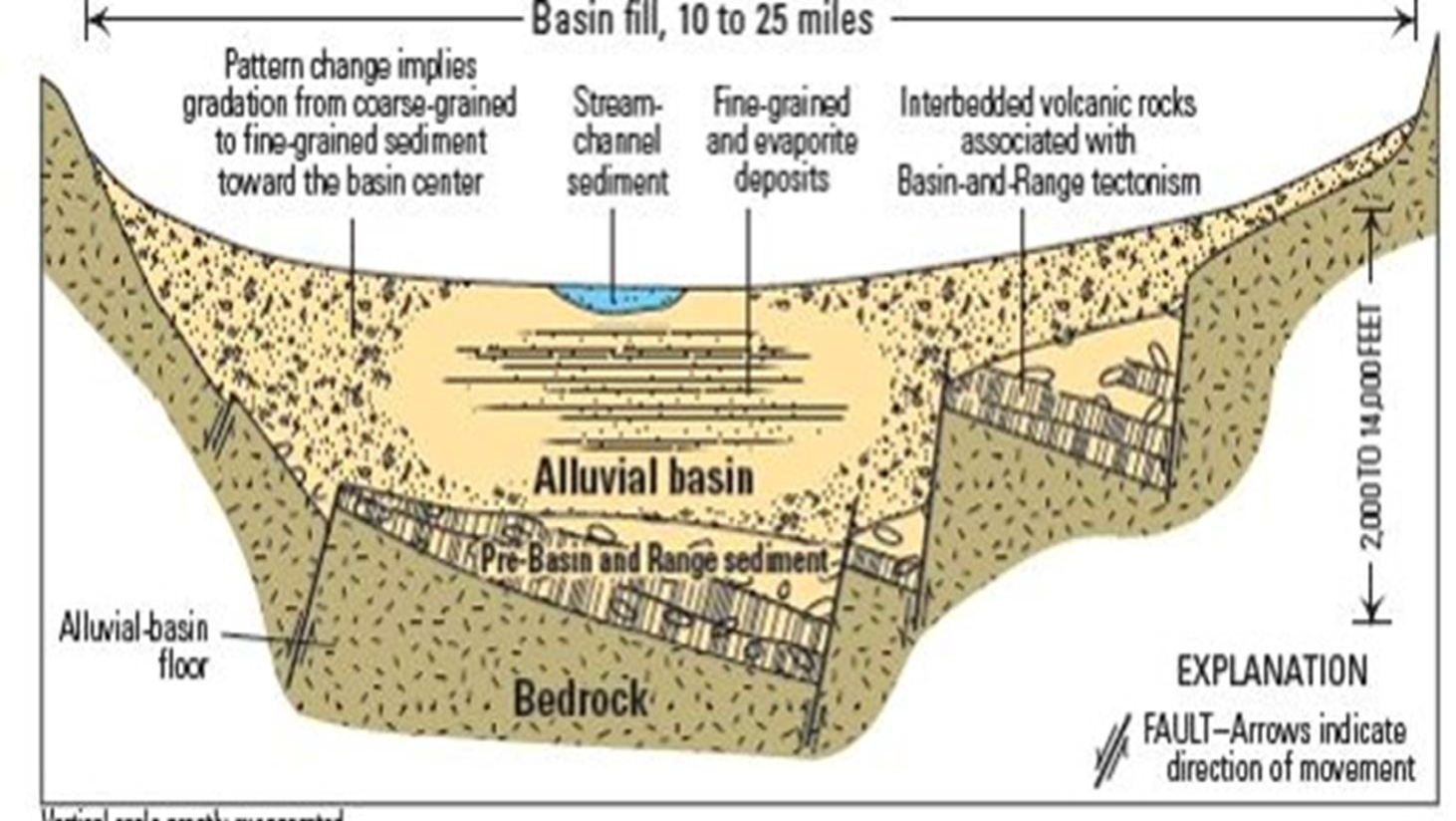
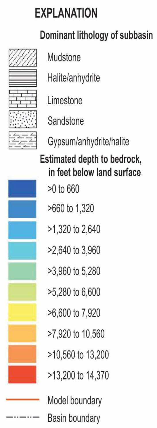
- Mohave County’s Basin and Range, basin-fill type aquifers consist primarily of sediment-filled basins separated by mountain ranges
- Basin-fill deposits typically range from about 1,000 to 7,000 feet in thickness but are thinner or thicker in some locations
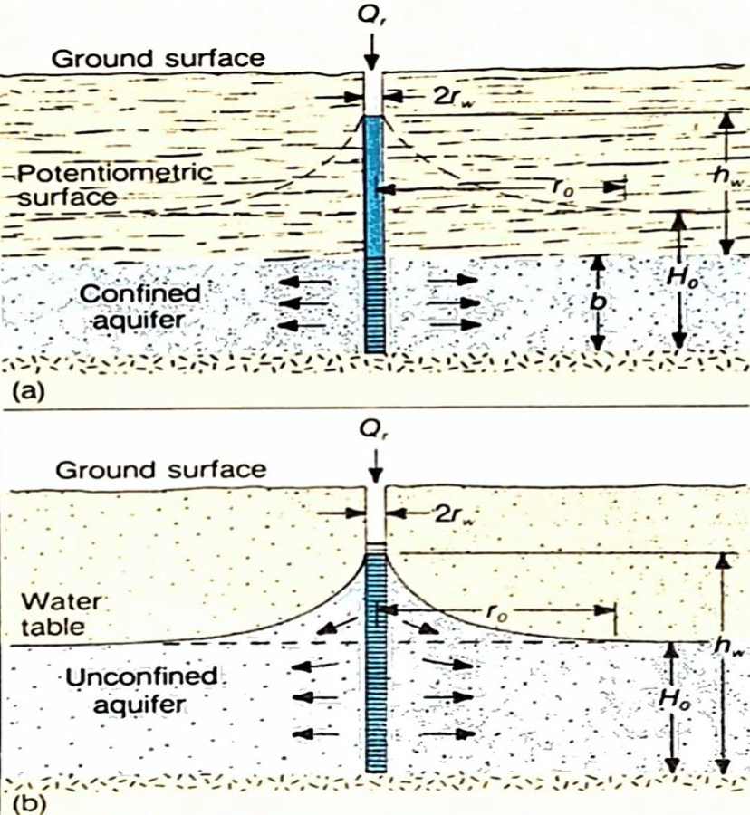
- Groundwater is mostly unconfined
Functions of Groundwater Systems
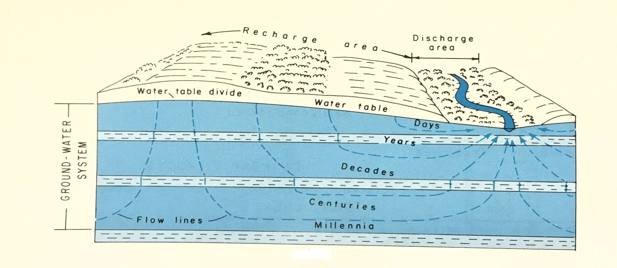
For the major Mohave County groundwater aquifers:
- Most precipitation is lost to evapotranspiration
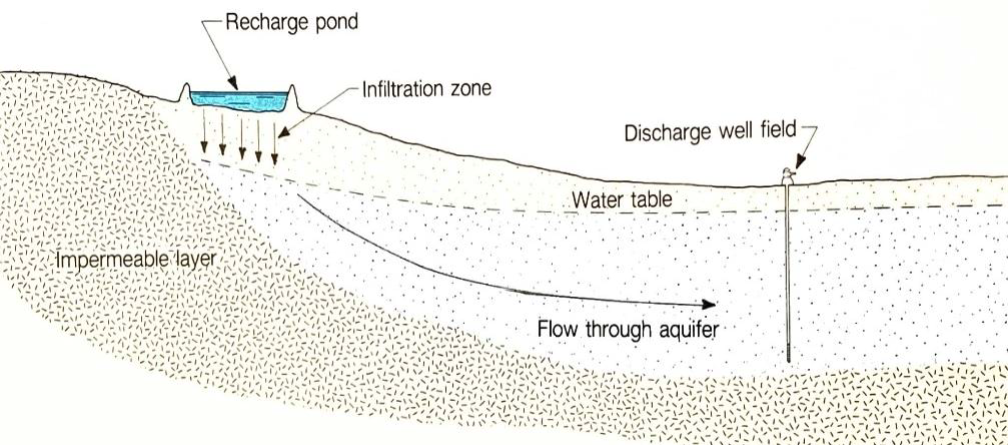
- Groundwater is recharged from infiltration of mountain streams along the foothills of the mountains
- Groundwater flow through the sediments of the aquifer can take years or decades
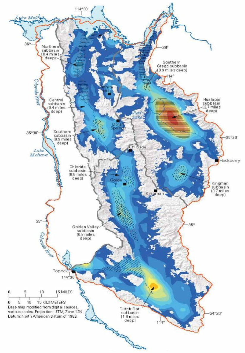
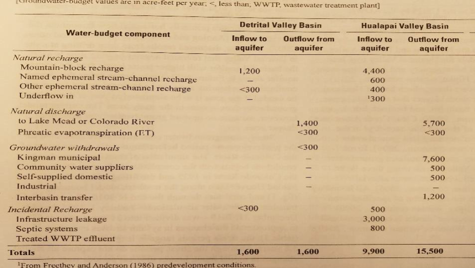
In the Hualapai Basin Aquifer the water discharge historically has exceeded the discharge, creating a Water Budget deficit
In the Hualapai Basin Aquifer the Outflow from the Aquifer (discharge) historically has exceeded the Inflow to the Aquifer (recharge), creating a Water Budget deficit
According to USGS estimate, in 2011 the annual
- Inflow to the Aquifer (recharge) was 9,900 acre-feet; Outflow from the Aquifer (discharge) was 15,500 acre- feet, thus
- creating an annual water deficit of 5,600 acre- feet
(Reference: USGS Scientific Investigations Report 2013-5122; Preliminary Groundwater-Flow Model of the Basin-Fill Aquifers in Detrital, Hualapai, and Sacramento Valleys, Mohave County, Northwestern Arizona)
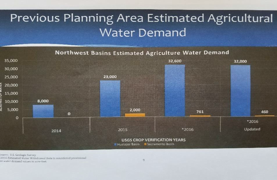
According to AWDR estimate, in 2016 the annual agricultural use of groundwater, and the associated Outflow (discharge) from the Aquifer increased by an additional 32,000 acre-feet, thus increasing the annual water deficit in the Aquifer to 37,600 acre-feet
(Reference: ADWR Northwest Basins Planning Area Water Demand Update, Stakeholders Meeting, May 18, 2017)
USGS Model to Establish the Groundwater Conditions
The U.S. Geological Survey (USGS) MODFLOW model will assess the impacts of increased withdrawals on aquifer conditions and predict the effectiveness of potential increased groundwater infiltration;
It will be used to predict the impact of the increased well pumping in specific areas of the basin, and more importantly, the anticipated time frames for the change of water levels in specific areas of the aquifer;
It will also be used to predict the impact of anticipated different scenarios of water discharging and enhanced infiltration.
Mohave County will provide input to the model:
- Assist with locating areas where the County is most concerned with future drawdown, such as the City of Kingman's well field, etc.; and
- Provide the locations of potential enhanced infiltration areas.
POSSIBLE MITIGATING MEASURES TO FACILITATE INCREASED INFILTRATION INTO THE AQUIFERS
1. Locate major washes
2. Check on potential surface water right allocations and Waters of the U.S. designations
3. Find suitable and affordable properties along washes
– private property donations
– BLM lands
– County and City right-of-ways and drainage parcels
4. Engineering evaluation of
– storm water flow and quantities,
– geotechnical properties and infiltration capacity of the subsurface soils, and
– feasibility of construction
Engineering Evaluations for Site Selection
- For each wash, check and comply with potential surface water right allocations
- For each wash, establish by engineering hydrology the anticipated surface flow and quantities (10% annual probability)
- Engineering calculations for the available amount of water at each location
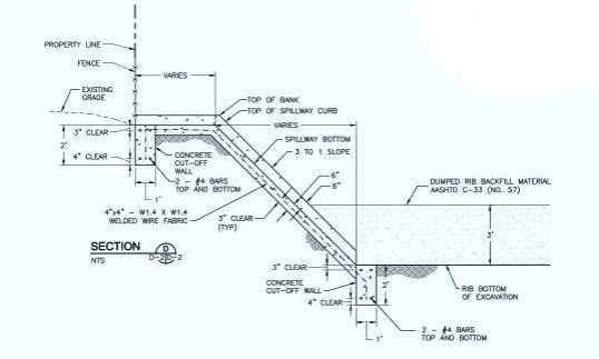
- Sites containing underlying subsurface soils of clean sand and gravel with negligible fines content will be suitable for infiltration without any further engineering measures
- For sites consisting of near-surface soils with relatively high fines content (silt or clay), the installation of more complex facilities will be required
- Evaluate site geometry and suitability for construction
- Conceptual engineering design
- Engineering cost estimate
- Cost-benefit evaluation of the specific site location
Methods for Enhanced Infiltration
Shallow basins
1. May be developed by spreading the water on the ground surface over a large area; or
2. Enhanced by excavation and by filling series of berms
Deeper basins
Constructed by excavation and placement of free-draining gravel
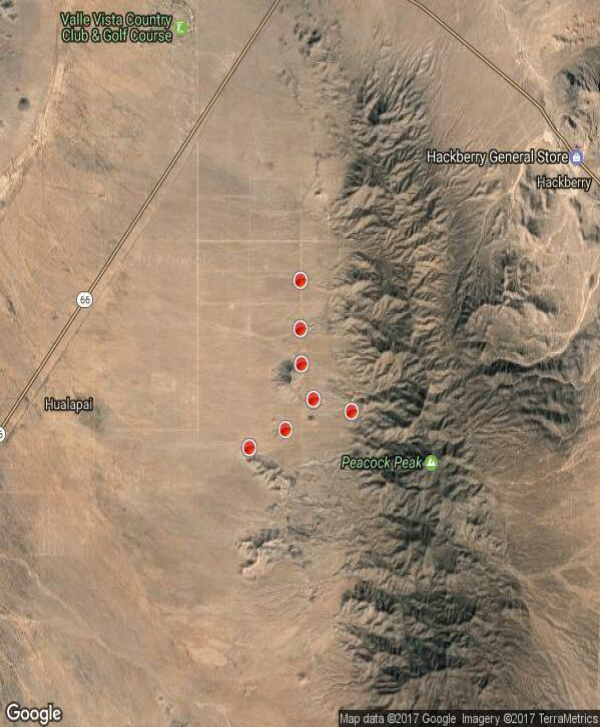
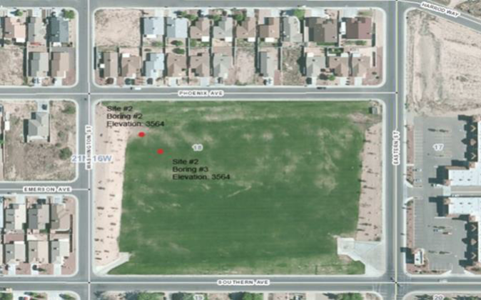
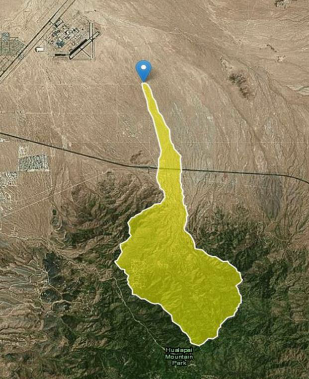
Potential Infiltration Sites in Peacock Mountains Utilizing Existing Ponds on Private Properties
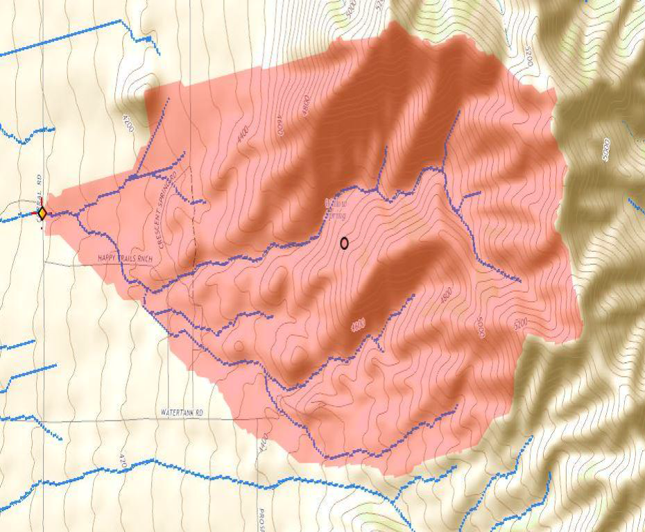
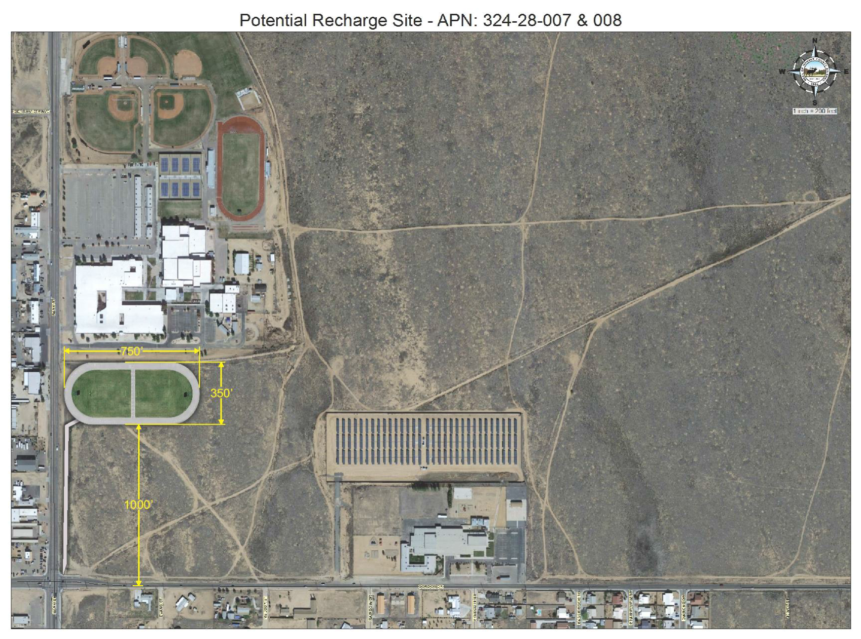
Potential Infiltration Sites in the Kingman Area
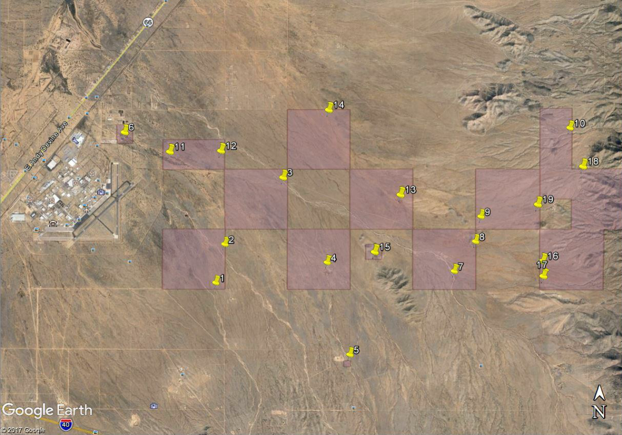
Potential Infiltration Sites on Mohave Agrarian Property
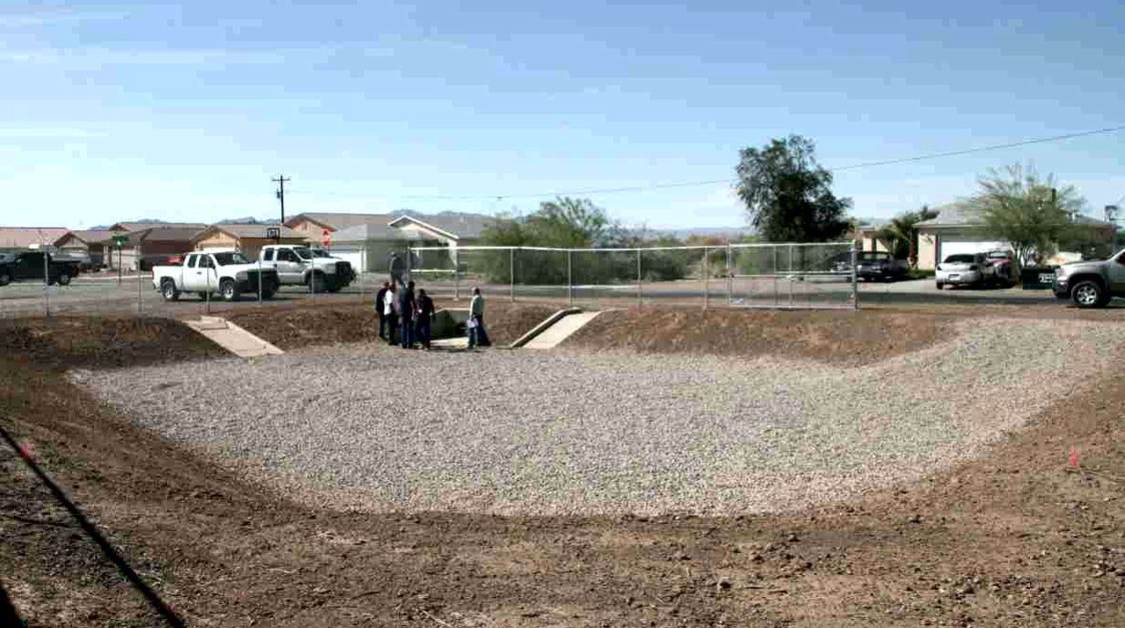
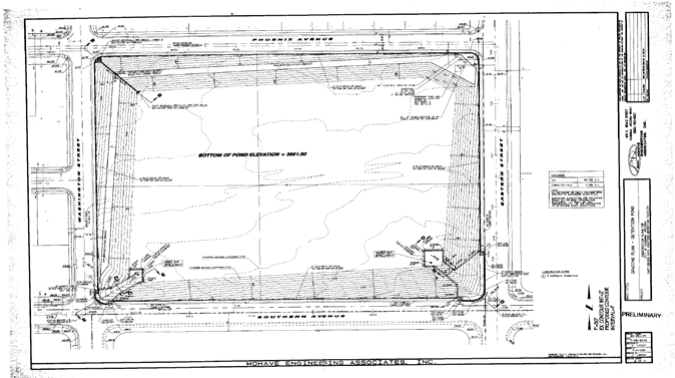
Project Example Designed and Constructed by Mohave County Flood Control District
Quail Run Infiltration Basin Project