FEMA Flood Map Viewer Instructions
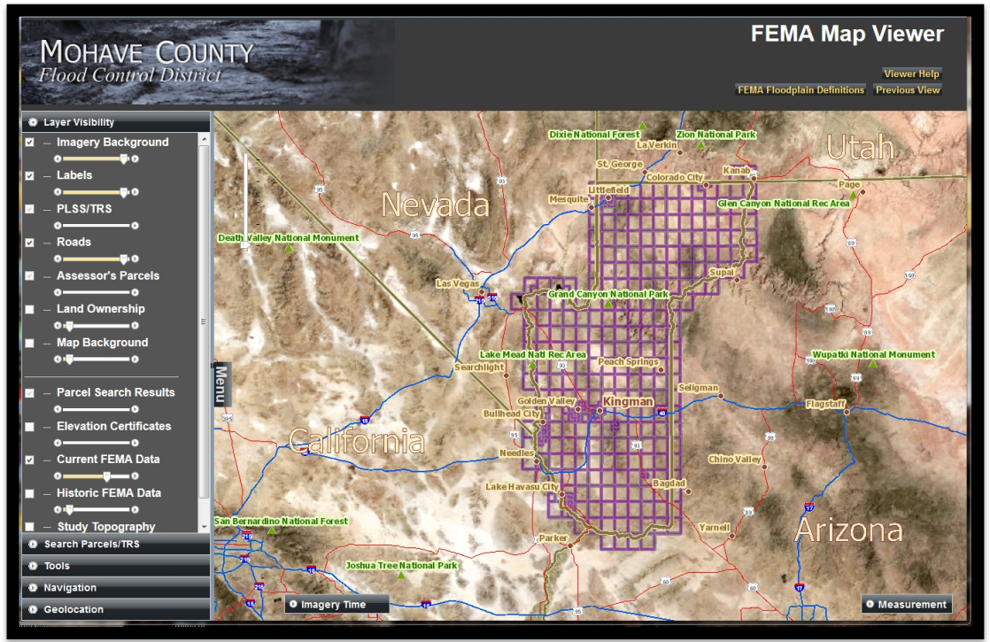
Mohave County Flood Control District FEMA Map Viewer
https://mcfloodgis.mohave.gov/Flood_Control_Data/FEMA_Data.html
The Mohave County Flood Control District has developed this FEMA Map Viewer in order to provide the public with the best information available about their property and the associated flood risk.
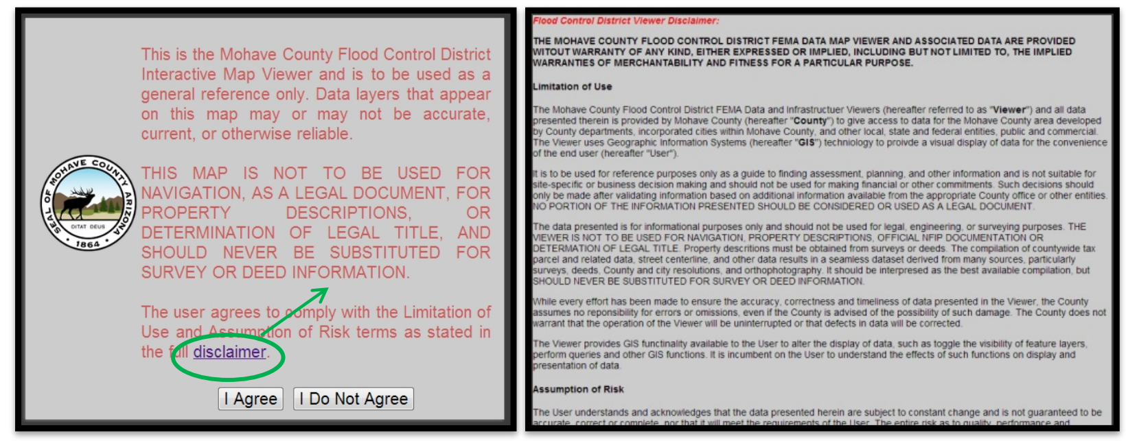
You may access the FEMA Map Viewer from several locations throughout our website. When you click on the link, the first screen is a short Disclaimer. Please take the time to read the full Disclaimer, before clicking I Agree.
Welcome to the FEMA Map Viewer!
On the left side of the screen is the Menu. The menu lists the five
components of the viewer:
Layer Visibility
Search Parcels/TRS
Tools
Navigation
Geolocation
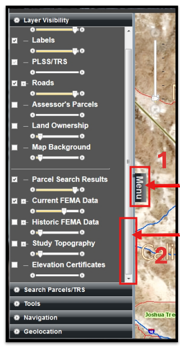
1. The Menu window can be hidden by clicking "Menu"
2. The width of the Menu window can also be resized by placing your
mouse along this line until you see a symbol like this: ← || →
This document will now take you through each Component as well as some other features of the FEMA Map Viewer.
The Layer Visibility Component
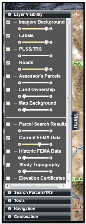
This component allows the user to view several layers at once, as well as change the transparency of each layer. As you check the boxes to turn on or off the layers, you will become familiar with how they look and can then customize the Viewer to your needs when you open it.
Please note that some layers are only visible as you zoom in. Sometimes you have to zoom out in order to select or deselect layers.
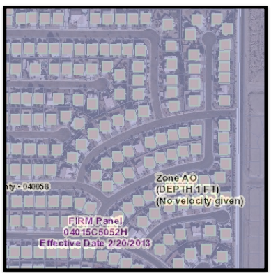
The layers that open by default are Imagery Background, Labels, Roads and Current FEMA Data.
To go to another Component, click on the title.
The Search Parcels/TRS Component
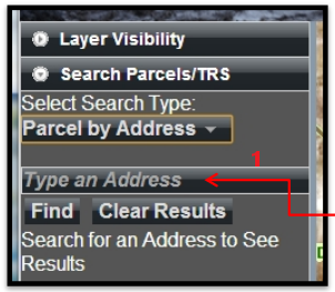
This component allows the user to search for parcels in several different ways: Owner Name, Address, APN (Assessor’s Parcel Number) and Township-Range-Section.
The default search is by Address. Click on the Select Search Type dropdown to choose another way to search.
Click this box to type in your search criteria. You must have a complete APN or Township Range and Section to use either of those search types. However, when using the name or address search types, you can use a partial name or address.
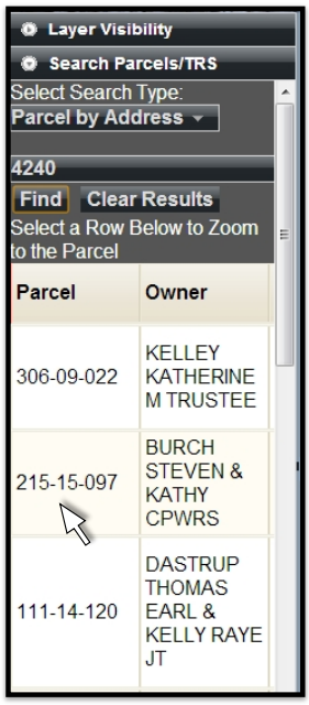
For example, if you only have the street number, your results would look like this.
If you do not see the record you are searching for in the list of records displayed, often there are more records available below what is able to be seen in the small window.
To locate the additional search results, place your cursor over the search results displayed and use the scroll feature of your mouse to scroll down to the record you are looking for. If you do not have a scroll feature on your mouse, you can left click anywhere in the records showing and use the down arrow key on your keyboard.
When you have found the desired record, left click anywhere in the row of that record and the Viewer will Zoom to that parcel.
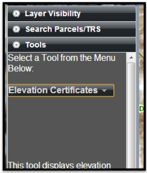
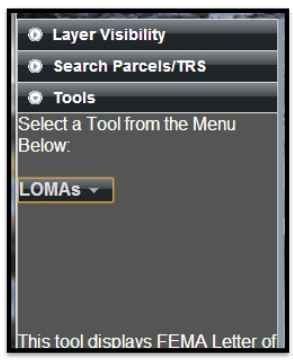
The Tools Component
There are several Tools available for use in this component:
Print Webmap
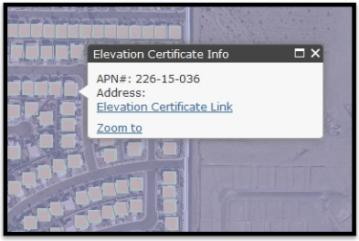
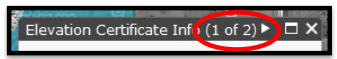
Elevation Certificates
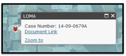
LOMAs
Parcel Information
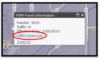
FIRM Panel
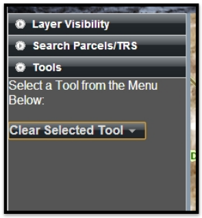
Clear Selected Tool
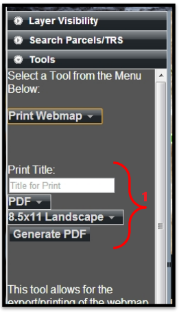
1. The Print Webmap tool
This tool allows the user to print what they are seeing on the screen. You can also choose a Title for your map.
When you have typed in your Title, chosen your Format (PDF, PNG32, PNG8, JPG,GIF, EPS,SVG, or SVGZ) and Size, click the Generate button.
After a couple of minutes, a new link will open. Click to open your map.
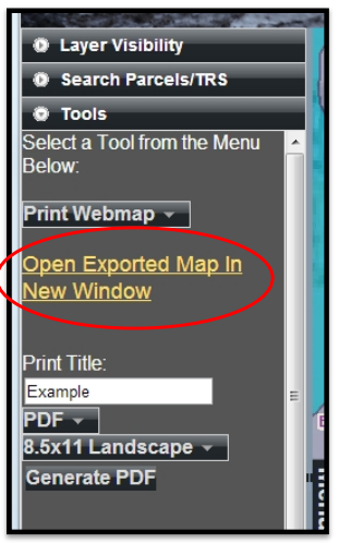
the map.
Any LOMA will be indicated on the map with the following symbol:

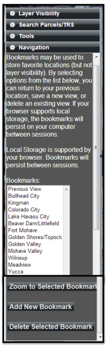
In this component, the Flood Control District has loaded several bookmark locations, similar to the bookmarks in the Mohave County GIS map. By selecting a bookmark from the Bookmarks window, then clicking on the Zoom to Selected Bookmark button below the Bookmarks window, the viewer will zoom to that area.
Below the Zoom to Selected Bookmark button are two more button used to customize the bookmarks: Add New Bookmark and Delete Selected Bookmark.
To create a new bookmark, zoom to the area you would like to bookmark, click Add New Bookmark and a pop-up window appears requesting a name for the bookmark. After you have named your bookmark, click OK and your bookmark will appear in the Bookmarks window. If your browser supports local storage (cookies), the bookmarks you create will be present the next time you open the viewer.
Note: Bookmarks are only at the City (2) zoom level. You cannot set a bookmark to a specific parcel.
The Delete Selected Bookmark button will delete any bookmark you have selected in the Bookmarks list. Be cautious! This button will not ask if you are sure you want to delete it.
The Geolocation Component
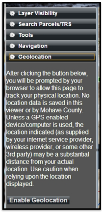
This component allows the user to give permission to the page to track their physical location. Please read the information available before clicking the Enable Geolocation button.
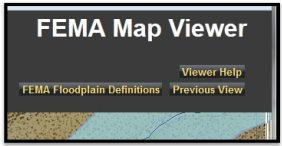
There are a couple more functions of the Viewer that are outside of the 5 components. In the top right corner, there are three buttons. Clicking on the” Viewer Help” button opens these instructions. If you need help with something that is not within this document, please contact the Flood Control District at 928-757-0925 or MCFloodInfo@mohave.gov
Clicking on the button that says “Previous View” simply opens the last view on the screen, whether it is a zoom in or out, or the last parcel you searched for.
Clicking on the “FEMA Floodplain Definitions” button will open a new window with a document that defines the FEMA Flood Zones that are relevant to Mohave County
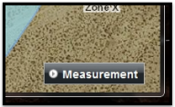
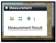
Another function on the main screen is a Measurement tool, located in the bottom right corner. There are 3 parts to the Measurement tool: Measure Area, Measure Distance, and Latitude/Longitude.
Click Measurement to open the window.
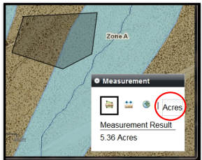
The icon on the left is the Measure Area tool. This tool allows you to draw any
shape to find the total area.
Once you have drawn your outline, double-click to close the shape and the Measurement Result appears at the bottom of the window. The default result is in Acres. If you click on Acres on the right, you can change your result to Square Miles, Square Feet, or Square Yards.
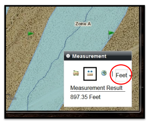
The icon in the middle is the Measure Distance tool. This tool allows you to draw any length line to find the total distance.
To measure a straight distance between two points, click the first point then double-click the second point and the Measurement Result appears at the bottom of the window. The default result is in Feet. If you click on Feet on the right, you can change your result to Miles.
If you want to measure from one point to another, along a road or property line for example, you can single click the first point and each change of direction point, then double click the final point to get the total distance along that line.
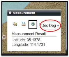
The icon on the right is the Latitude/Longitude tool. This tool allows you to click on any location to view the Latitude and Longitude for that location.
Once you have clicked your location, the Measurement Result appears at the bottom of the window. The default result is in Decimal Degrees. If you click on Dec Deg on the right, you can change your result to DMS (Degrees-Minutes-Seconds).
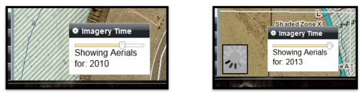
On the bottom left of the map, there’s a retractable window called Imagery Time.
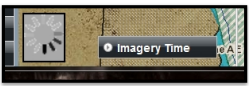
In various locations of Mohave County, the Flood Control District has aerial photography from different years. When you click on Imagery Time, the window opens and you will see a scroll bar. By
moving this scroll bar to the left or right, you will see the years in which aerial photographs may be available in the area you are searching. The default year for the imagery is 2010.
If you have additional questions or the map viewer is not responding correctly, do not hesitate to contact us at 928-757-0925 or MCFloodInfo@mohave.gov